Mount Tahan

Mount Tahan, at 2187 m, is the highest point in Peninsular Malaysia. It is located within the Taman Negara National Park.

The Meromictic Lake: Penang National Park

A meromictic lake is a lake that contains a partially mixed or wholly unmixed water layer that combines with the main water source during a given cycle.

Eagle watching at Penang National Park

White-bellied Sea Eagle (Haliaeetus leucogaster)- can be considered an icon of the park as it is easily sighted.

Fern And Green Undergrowth

Hundreds of fern species can be found in the rainforest of Malaysia

Rainforest Taman Negara

Explore the truly tropical rainforest in Taman Negara Pahang.

Kerachut Beach Sunset

Beautiful and Magnificent Sunset at Kerachut Beach.

Royal Belum State Park

Royal Belum awaits discovery as one of the most magnificent and least explored protected areas in Malaysia.

Monday, December 21, 2015

Taman Negara Terengganu,National Park Tanjung Mentong, Terengganu


Tanjung Mentong is the state's entry point to Taman Negara, Malaysia's premier national park which has one of the world's most complex and rich eco-systems. Trekking the forest to view flora and fauna. Climbers will enjoy a hike up Mount Gagau, one of the highest peaks in Taman Negara at 1,376m where they can get a view of all three states (Pahang, Kelantan and Terengganu) in the park. There are two caves nearby, Gua Bewah and Gua Taat. Discover the cave ecosystem where artefacts were found dating back to 4,000 BC.

How to Get There
Visitors can reach Tanjung Mentong through the two jetties in Gawi or Jenagor, all in Terengganu. Kuala Berang is the nearest town to these jetties. The trip cuts across Tasik Kenyir, the largest man-made lake in Malaysia will takes 45 minutes

Permit and License
Each visitor must obtain an entrance permit at RM1 per person. Fishing licence costs RM10 each while camera license is RM5 per camera. 

Accommodation
There are 5 chalets and a 60-bed hostel. Tanjong Mentong Resort is managed by local operators. There is jetty, restaurant, meeting hall and a viewing tower.

For further information, please contact :

Deputy Superintendent 
Taman Negara Terengganu National Park, Tanjung Mentong, 
Hulu Terengganu, Terengganu 
Tel: 09-622 7751

Manager 
Tanjung Mentong Resort 
Tel: 09-623 6684 
Fax: 09-631 6684

Sunday, June 10, 2012

Royal Belum State Park - Royal Forest


The Royal Belum State Park is a huge park in the northern parts of Peninsular Malaysia. It is part of the even bigger Belum-Temengor Forest Complex (BTFC) that is shared with Thailand. Together with Taman Negara National Park it is one of the oldest rainforest in world, dating back over 130 million years. Belum is a state park and not an official National Park. This means that local government is allowed to use the area for production forest and it is open for future development. There are efforts to get the government to gazette Belum as a national park, though up till now only a part of the huge forest is conserved and protected as state park. Belum has the potential to become one of Malaysia's premier eco-tourism destinations, if managed well.

The Royal Belum is composed mainly of pristine tropical rainforest, with many river systems, and small grassland areas, some abandoned agricultural plots, and Tasik Temengor, a large man-made lake. Forests found here include lowland dipterocarp, hill dipterocarp and lower montane types with a distinctive northern element as the area borders Thailand. The Royal Belum is part of the larger Belum-Temengor forest landscape, one of the largest blocks of forest in Peninsular Malaysia.

Wildlife surveys show that Royal Belum is an important habitat for large mammals like the seladang (Bos gaurus), Asian elephant (Elephas maximus) and Malayan tiger (Panthera tigris jacksoni). The area is also home to the endangered Sumatran rhinoceros (Dicerorhinus sumatrensis), one of very few left in Peninsular Malaysia. Belum-Temengor is the only forest in Malaysia with all 10 species of Malaysian hornbills including large flocks of the plain-pouched hornbill (Rhyticeros subruficollis). 


Getting There
Getting to the lush Rainforest of Belum which situated about 300km from Kuala Lumpur, is to head overland via Kuala Kangsar (TR 1) and Grik (TR 76), and then onto the east-west highway (TR 4) to Banding Island (on Temenggor lake).


Visitor's Info :

Accommodation
There are quite a few decent resorts nearby Royal Belum State Park, the resorts are usually located at the shores of Lake Temenggoh. As most resorts are at a distance apart it is not easy to stay at one resort and eat at another resort, you are basicly limited to what the resort has to offer. Rule of thumb is that locals meals are of much better quality than western styled meals. Most popular resorts around Royal Belum State Park are; Belum Rainforest Resort (offers free WIFI in public areas), Belum Eco Resort and the Banding Lake Side Inn. The great thing about the resorts at Belum is that you can easily book a package deal that includes a 3D/2N or 4D/3N stay, breakfast and also all daily activities and tours. This means no difficulties finding a suitable tour up front (which is somewhat of a problem at Lake Kenyir, as there you can only participate in tours if there are enough people that are interested in that tour).

Facility

• Camp site
• Jetty
• Hanging Bridge
• Toilets
• Bathrooms
• Gazebo
• Open Hall
• Open Kitchen
• Wildlife Hide

Activity
• Jungle Trekking
• Overnight Stay at Wildlife Observation Hide (Bumbun)
• Visiting Orang Asli (aborigines) Settlement
• Angling / Fishing
• Bird Watching
• Boating
• Camping
• Swimming
• Waterfalls
• Traditional Bamboo Rafting
For further information, please contact :

Perak State Park Corporation
Tingkat 1, Kompleks Kerajaan Negeri
Daerah Hulu Perak
33300 Gerik, Perak Darul Ridzuan
Tel: 605-791 4543
Fax:605-791 2641
         

Taman Negara Kelantan,National Park Kuala Koh, Kelantan


Taman Negara Kelantan ( Kelantan National Park), Kuala Koh is the only official entry point in the state of Kelantan to Taman Negara. Located at the end of an oil palm estate, Kuala Koh is unique as compared to the more populous Taman Negara Kuala Tahan. Kuala Koh is situated at the conference of Sungai Lebir and Sungai Koh. Taman Negara Kuala Koh is part of the Peninsular National Park covering 4343 sq km which includes the state of Kelantan, Trengganu and Pahang. It is home to many unique species of flora and fauna.
  
Visitor's Info : 
  
Recreational Activities 
Bird Watching
There are over 300 species of birds in Taman Negara. Experienced bird watchers may be able to spot more than 150 species within a few days.
Fishing
There are some great fishing spots here. However, take note that fishing is prohibited in certain rivers, as these rivers are designated breeding grounds for certain species of fish.
Photography
A photographer's paradise, Taman Negara is blessed with exquisite beauty. Explore the limitless possibilities with a variety of flora and fauna.
Jungle Trails
Several interpretive trails are available around Kuala Koh. One of them is located across the river, where visitors have to make their way across a suspended bridge.
Kayaking
The crystal-clear rivers around Kuala Koh provide the perfect spots for kayaking.


Permit and License
Each visitor must obtain an entrance permit at RM1 per person. Fishing license costs RM10 each while camera license is RM5 per camera.

Accommodation
Since February 2006, accommodation, food and activities are managed by a private operator. There are chalets, hostels as well as a campsite available for overnight stay.

For further information, please contact :

Pejabat PERHILITAN
Jajahan Gua Musang
Wisma Persekutuan
18300 Gua Musang
Kelantan
Tel/Fax: 09-912 2940

Taman Negara Kelantan, Kuala Koh
18300 Gua Musang, Kelantan
Tel: 09-928 2952

Gunung Benum,Krau Wildlife Reserve, Pahang


Background
Krau Wildlife Reserve, where lies the Mount Benum is the oldest protected areas in Malaysia. It was gazetted on 9 June 1923 with an area covering 62,395 hectares. This reserve is the second largest wildlife refuge in Peninsular Malaysia after Taman Negara. 


Gunung Benum is the tenth highest mountain in Peninsular Malaysia with a height 2107 meters (6916 feet) above sea level and is the second highest mountain in the Peninsular Malaysia after Gunung Tahan. Gunung Benum located between the borders of three districts of Jerantut, Temerloh and Raub. The topography of this area covers hilly with a flat low-lying marshy areas in several parts of the reserve. In addition, the area is covered by dipterocarp forest up to the mountain forests.


.
Climbing Gunung Benum
 
Climbing to the summit of Gunung Benum is an experience you will not be forgotten by the climbers. The trails can be categorized as hard or hardcore trail and have panoramic views with the rapids and cascades at the foot of the mountain along the way back. Water sources in several camping sites can only obtained from the catchment tank and the climbers should bring along the water needed during their trip.

Day 1:
Registration, appoint guide and climbing equipments inspection. Distance to the first campsite at Jeneruh Camp is about 9 km. Water source available from Sungai Jeneruh.
Day 2:
The distance from first campsite to second campsite at Gunung Lilin is about 4.5 km. Water source are from water catchment tank and climbers are advisable to bring extra water supply.
Day 3:
Journey to the third camp site at Permatang Angin. Water resources are from catchment tanks. Distance from second camp site to Permatang Angin is about 5 km.
Day 4:
Journey to the summit is about 3.5 km and the distance to Permatang Gunung Cermin camp site is about 7.5 km. The climbers are required to bring water to be used at the fourth camp site.
Day 5:
Journey to the 5th base camp at Lata Bujang. Water source are from nearby river with a panoramic view of 6 steps waterfalls. Distance to Kem Lata Bujang is about 6 km and climbers will continue another 8.5 km before exit at Perlok Office. 

GUNUNG BENUM CLIMBING TRAIL DISTANCE (KM)
Pos Perlok – Jeneruh Camp 9
Jeneruh Camp – Gunung Lilin 4.5
Gunung Lilin – Permatang Angin 5
Permatang Angin – G. Benom summit – Permatang Gunung Cermin 11
Permatang Gunung Cermin – Lata Bujang Camp 6
Lata Bujang Camp – Post Perlok 2.5


For more information, please contact:
 
Director
Krau Wildlife Reserve Management Unit
Department of Wildlife and National Parks
Bukit Rengit, 28500 Lanchang, Pahang
Tel: 609-2790585
Faks/ Fax: 609-2790586

National Elephant Conservation Centre, Kuala Gandah, Pahang

National Elephant Conservation Centre, Kuala Gandah, Pahang 

The Department of Wildlife and National Parks (DWNP) established National Elephant Conservation Centre in 1989. The centre is a base for the Elephant Relocation Team, which began the elephant translocation programme in 1974.

The only one of its kind in Malaysia, the team is dedicated to locating, subduing and then translocation problem elephants from areas where their habitats are constantly being encroached by plantations, to other suitable habitats throughout Peninsular, including Taman Negara National Park. Over the past 30 years the 24 strong team has helped to prevent the further decline of the elephant population by relocating more than 450 wild elephants.
In addition of being the home to the translocation team and a herd of resident elephants, the centre also carries out public awareness activities related to the conservation issues of elephants in Malaysia. It also supports research activities on elephant translocation and conservation. The centre is open to visitors throughout the year. Visitors can ride the elephant within the centre; assist in bathing and feeding them.

The awareness activities strive to educate the public about the importance of the species and habitat protection. Visitors are encouraged to view a video presentation on elephant translocation at the centre. Upon request special programme can be arranged for school groups. A scheduled visitor’s programme is available, which could be referred under the “Visitor Timetable” below.

The Resident Elephants at the Centre
The centre houses a number of resident elephants which were brought in from Thailand and Myanmar. These elephants are trained and used in translocation exercise of catching problem wild elephants in throughout Peninsular Malaysia. The centre also looks after orphaned elephants to ensure their continued survival.

The Asian Elephants
The Peninsular Malaysian elephants belong to the Asian elephants (Elephas maximus) is listed as a critically endangered species, with less than 40,000 wild elephants in Asia, including a maximum of 1,200 wild elephants in Peninsular Malaysia. Protecting the Asian elephants help safeguard thousands of other species within its habitat. The elephant creates vital natural pathways by knocking over trees, allowing smaller species to feed, as well as dispersing plant seeds in its dung. However, due to habitat loss, elephants are forced to hunt for food in convert areas surrounding forest such as plantations, where they raid crops on a massive scale. This is why the translocation team has such a dire responsibility to move these elephants, to prevent them from otherwise being shot by farmers, or simply dying of starvation.
Image Source:http://www.myelephants.org

Visitor Timetable at the Centre
Visitors are encouraged to participate in activities from 2.00 pm onwards.
Time
 Activities
 2.15 pm
ELEPHANT RIDE
Visitors are invited to ride and elephant around the centre.
 2.30 pm
BATHING
Visitors can join the elephants as they bathe and swim in the river under staff supervision.
 3.30 pm
FEEDING
Visitors can participate in feeding the elephants, their dinner of banana, carrot, papaya etc.
 3.45 pm
VIDEO SHOW
Visitors may view a video on issues surrounding wild elephants, diminishing habitat and translocation
Here you’re not only able to watch elephants in the wild, but also feed, ride and swim with them
How to Get There
Visitors are encouraged to contact the centre to facilitate arrangements and to determine whether the centre can accommodate your visit especially if you are coming in a big group. Visitors are advised to bring with them additional clothing should they wish to participate in bathing activities with the elephants in the river. The centre welcomes visitors to the National Elephant Conservation Centre with the aim of educating with outdoor activities.


No admission fees but donations can be contributed to the elephant trust fund. www.myelephants.org

Your Support and Contribution Needed
The National Elephant Conservation Centre at Kuala Gandah is managed by the Department of Wildlife and National Parks Peninsular Malaysia. Continuous efforts are being undertaken to enhance the existing facilities either for research and development or visitors to the centre. The Department strives to make this centre as the region’s most outstanding elephant training and conservation centre. We welcome any form of assistance and support.

Enquiries pertaining to assistance and contribution can be forwarded to the staff at the centre. The Department of Wildlife and National Parks Peninsular Malaysia has established the Elephant Trust Fund to facilitate donation from the public. You can also forward your enquiries by writing to the following address:

Head
National Elephant Conservation Centre (NECC)
Department of Wildlife and National Parks (DWNP/PERHILITAN)
Kuala Gandah, 28500 Lanchang
Pahang Darul Makmur
Tel: 09-2790391
 THIS ELEPHANTS NEED YOUR DONATIONS
For more info, go to Donation pages


Monday, May 28, 2012

Penang National Park

Pulau Pinang National Park


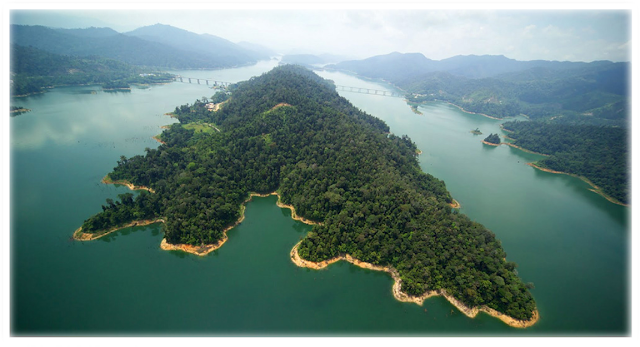
Pulau Pinang National Park is located at the northwest corner of Penang Island overlooking the Straits of Malacca. The park is about 475 km from Kuala Lumpur and about 30 km (45 minutes) from Georgetown, Penang.


meromictic lake
The park caters for day use visitors only. There will be no accommodation and campsite for tourist so as to minimize human impacts on the park. Overnight camping is offered only through organized nature camp / conservation education programs by the Park Service for schools, colleges and higher learning institutions. Visitors / tourists should stay at the numerous hotels available at Batu Ferringhi and Telok Bahang, a well-established tourism area. These areas are well supported with food outlets,convenient stores, souvenir shops, entertainments, clinics and other tourist services.

The natural attractions of Pulau Pinang National Park include the Hill / Lowland Dipterocarp Forests, Mangrove Forest areas,sandy beach habitats, the unique seasonal meromictic lake and the open coastal seas. Stands of Seraya (Shorea curtisii) trees, common feature of coastal Dipterocarp Forest, can be easily seen on steep slopes around Muka Head. There are over 1000 species of plants recorded which are dominated by the family Dipterocarpaceae, Leguminoceae, Apocynaceae, Anacardiaceae, Euphorbiaceae and Moraceae.

How to get there

By own transport, drive through the North South Expressway, exit at the junction of Penang Bridge. Follow the road towards the direction of Batu Feringghi and continues to Teluk Bahang. Administrative Office of the Penang National Park is located at Jalan Hassan Abbas. Public transport to Teluk Bahang available at ferry terminal / KOMTAR or may use taxi services provided.

The main entrance to the park is through Telok Bahang while the second entrance point located at Kuala Sungai Pinang, Balik Pulau. Recreational facilities for visitors are only available at Pantai Kerachut, Sungai/Teluk Tukun, Pasir Pandak, Teluk Aling, Teluk Duyung dan Muka Head Light House. A nature trail also looped around the unique meromictic lake at Pantai Kerachut.

Teluk Tukun

At the mouth of Sungai Tukun, it is only a short 15-20 minutes walk from Park HQ. Suitable for picnics as well as those who want to stay overnight. There is a pool with the water sourced from the river. Great for a cool and refreshing dip, especially on a hot day. After the upgrades, it now contains complete facilities for campers. Toilets, showers, cooking pits and camping spots are among the amenities provided. A short walk into the jungle, one can discover a rich variety of flora and fauna. It has direct paths to other parts of the park, including Pantai Kerachut and Muka Head.

Teluk Aling

Universiti Sains Malaysia (USM) Marine Research Centre is located here. There is jetty here for the centre's use. It is a short stretch of beach.

Teluk Duyung

Popularly known as Monkey beach, named after monkeys that loiter around here. Some people also refer to here as Muka Head. A pretty long stretch of beach. You should be able to reach here from Park HQ in less than 1 and a half hours. Many hotels provide packages that includes the boat ride and BBQ lunch. You can camp here, although the facilities are not as good as Teluk Tukun and Pantai Kerachut. There is a abadoned house owned by Loh Boon Siew. There is another house that sells drinks as well as providing boat services for those lazy to walk back.

Muka Head Lighthouse

At the far end of Teluk Duyung is the starting point for the climb up to the Muka Head Lighthouse. Built in 1883 at a cost of £37,929, it is located 242m above sea level. It is opened to public if the caretaker is in. Enquire at the house at Teluk Duyung on whether the caretaker is around. It takes between 30 minutes to an hour to reach the lighthouse, depending on your fitness. From here, you can get a spectacular view of the island. On a clear day, you would be able to see Pulau Langkawi and as far as Sumatra in Indonesia.


Pantai Kerachut

Located at the western side of the park, this is a beatiful stretch of beach. Facing the Straits of Malacca, it can get pretty windy and the sea can get pretty rough here. Camping facilities and amenities are provided here. It is also a turtle nesting ground, with a turtle sanctuary located here. It is the nesting place of the Green Turtles (Chelonia mydas) from April to August and the Olive-Ridley (Lepidochelys olivacea) between September and February.


Also not to be missed is the rare meromictic lake resulting from a seasonal phenomenon. During low tides and dry seasons, the lake becomes a field of mudflats, with hardy, terrestrial grass. During spring tides, seawater enters through a one metre wide opening to fill the lake slowly. It contains both sea water and fresh water layers which never mixes, hence the name meromictic. The cool fresh water is on the top while the warm sea water lies at the bottom. It takes about 1-1.5 hours to get here from park HQ. It is a little bit more challenging than the trail to Muka Head, as one has to climb up a hill to get here. However, it is definitely worth the time and effort.

Teluk Kampi

Located at the far south-western end of the Park, this is the longest beach in the Park. However, getting here is a little bit difficult, as the trail is not very clear. One has to climb up a steep hill before going down to the beach. There are several trails that goes here. The most convenient one would be the one that starts at the end of Pantai Kerachut. Make sure you have enough water and time to make the trip.

Activities

Among the activities provided at the Penang National Park, including camping, wildlife observation, canopy walkway, swiming, picnic, Interpretive Centre, fishing, jungle trekking climbing and canoeing.

Permit and License

There is no entrance fee for visitors to Taman Negara Pulau Pinang. However, for canopy walkway activity, the fee charged for adults is RM5.00 and RM3.00 for children.

Taman Negara Pahang,National Parks Kuala Tahan, Pahang

How To Get There
The nearest town is Jerantut, Pahang. The journey from Kuala Lumpur or Kuantan by car or public transport takes about 3 to 4 hours. From Jerantut, visitors can either take a bus or taxi to the Kuala Tembeling Jetty, which is about 16 km from Jerantut. Visitors from Singapore can board the night train, which stops at the Kuala Tembeling Train Station. From the Kuala Tembeling Jetty visitors have to take a boat to Kuala Tahan. The boat ride takes about 3 hours and the fare is RM35 per person one way. Boats leave Kuala Tembeling Jetty at 9.00 a.m., 1.00 p.m. and 2.00 p.m. daily, on a first come first serve basis. Visitors can also drive from Jerantut to Kuala Tahan. It takes about 1 hour to reach Kuala Tahan at Taman Negara.


Permit and License
Each visitor must obtain an entrance permit at RM1.00 per person. Fishing license costs RM10.00 per rod while camera license is RM5.00 per camera.

Facilities
Mutiara Taman Negara is the only accommodation in Taman Negara. Accommodation at Kuala Tahan consists of bungalows, suites, chalets and hostels. There are also campsites for campers at the park HQ area, around the park as well as outside the park. For more information on accommodation and activities, please contact Mutiara Taman Negara at 609-2662200 / 609-2663500 or fax to 609-2661500 or through e-mail at www.mutiarahotels.com.


Recreational Activities 
Wildlife Observation Hides

Stay overnight at hides and observe wildlife visiting the salt licks nearby. Charged RM5.00 per person per night. Reservations should be made ​​in upon arriving.
Canopy Walkway See Taman Negara from the longest canopy walkway in the world (550m), suspended 45 metres above ground. The charged is RM 5.00 for adult and RM3.00 for children
Cave Exploration Explore the unspoilt limestone forest comprising some of the most beautiful caves such as Gua Peningat, Gua Telinga, Gua Daun Menari and Gua Besar.
River Exploration A boat trip up Sungai Tembeling from Kuala Tahan is one of the most exciting activities, encountering numerous rapids.
Fishing Check out the cool fishing spots at Sungai Keniam. Camp out or stay overnight at Kuala Perkai fishing lodge.
Bird Watching It's a bird watching galore with 54 per cent of the 650 species of Malaysian birds found in Taman Negara
Climb Gunung Tahan The highest peak in Peninsular Malaysia takes at least 7days to scale, conquering its steep slopes and tricky rivers.
Visit Orang Asli Settlements Visit the Orang Asli or Aboriginal village to learn more about their culture and way of life.
Rapids shooting and whitewater rafting
Night River Safari
Experience the thrills of the currents at Sungai Tembeling.


Enjoy boating from Kuala Tahan to Cegar Sireh.


Climbing Gunung Tahan 
 
Background:

Gunung Tahan is the highest peak in Peninsular Malaysia (2,187 m) and is believed to get its name after designated as a restricted area (Forbidden) or 'the future hold or approach. The reason behind this prohibition is unclear, but the possibility is to keep the spirit of the mountain.. Since the end of the 19th century, many expeditions were conducted to explore and discover this mountain, headed by British citizens with the help of local residents.

Interestingly, many of the expeditions led by British colonials failed to reach the summit. This is where the emergence of the assumption of the role of a Malay Ruler when he prevented an expedition to explore the natural environment in our beloved country giving way for the possibility of these Malay Rulers becoming saboteurs to avoid our natural resources being plundered by the colonials. Opening of the trail to the summit of Gunung Tahan, starting with an expedition landing Sultan Ahmad in 1881 aimed at finding buried treasure on the mountain there are pots containing so-called 'mother' gold 'and' mother 'silver', he followed several other expeditions led by British explorers. During that period until 1905 which led to the discovery of the peak of Mount Tahan, some local residents’ names were listed such as Panglima Garang Joseph Headman Bakar, Chief Kakap Hussein, Datuk Tok Muntri Idin, Dolah and Mat Akib, wrapper, Mat Aris, Che Nik and Mu 'min, Mat and Mat Rifin Neck, Joseph Sukiman, Orang Dayak or Iban trackers.
 
Climbing Route
To reach the peak of Mount Tahan hikers can choose between two entry points whether from Kuala Tahan or Sungai Relau:
• Kuala Tahan - Gunung Tahan - Kuala Tahan 7 days 6 nights
• Kuala Tahan - Gunung Tahan - Kuala Juram (Merapoh) 7 days 6 nights

The original trail to the peak of Gunung Tahan from Kuala Tahan covers longer distance and is more challenging. Climbers need at least 7 days 6 nights to complete the climb. This route also requires hikers to cross seven rivers and climbing 27 peaks before reach the destination.
 

Route from Kuala Tahan - Gunung Tahan Peak (Altitude) and Estimated Distance (km)

Trail Kuala Tahan –Gunung Tahan Summit (Altitud)
 (KM)
Kuala Tahan (60m) – Melantai (100m)
12
Melantai (100m) - Gunung Rajah (576m)
9
Gunung Rajah (576m) – Putih (156m)
4
Putih (156m) – Teku (168m)
7
Teku (168m) – Wray’s Camp (898m)
5
Wray’s Camp (898m) – Pankin (1462m)
12
Pankin (1462m) – Gunung Tangga 15 (1500m)
1.5
Gunung Tangga 15 (1500m) – Gunung Reskit (1666m)
2.5
Gunung Reskit (1666m) – Gunung Gedung (2066m)
3
Gunung Gedung (2066m) – Gunung Tahan (2187m)
7